Geology and physical environment
A typical feature of the Wadden Sea is a seaward barrier of sandy islands and shoals which are a consequence of moderate tidal ranges, and sand having been supplied from offshore areas by waves and then moved by the wind.
Sea level rise has led to increasing tides. Today they range from 1.5 to 4 m. Below a tidal range of about 0.5 m, unbroken barrier spits and lagoons developed. Above approximately 3.5 m, barrier islands no longer occur due to the large tidal prisms.
In the southern Wadden Sea, twelve major barrier islands located 5 to 15 km off the mainland shore shelter the tidal area against waves generated by northwesterly and northerly winds. Sediment imported from the sea does not fully compensate for sea-level rise and islands migrate landwards.
In the central Wadden Sea, tidal ranges often exceed 3 m and there are four estuaries causing a lower and more variable salinity than in the other two regions. A seaward chain of barrier islands is absent. Here, sediment import seems to balance sea-level rise.
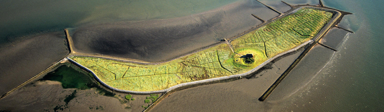
In the northern Wadden Sea, eight islands and elevated sandbars form a seaward barrier 5 to 25 km off the mainland. They provide shelter against waves generated by the prevailing westerly winds. Mostly, sediment supply does not compensate for sea-level rise, except for an oversupply between the islands of Rømø and Fanø. Several marsh islands are scattered across the tidal area. These are remnants of a coherent marshland which became submerged in late medieval times. In the North, some Pleistocene cliffs meet the sea.
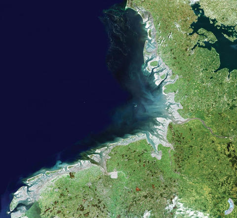
Satellite Map which shows the three sub-regions
Wadden Sea tidal basins
A distinctive hydrological feature of the Wadden Sea is a series of tidal basins, about 39 can be distinguished.
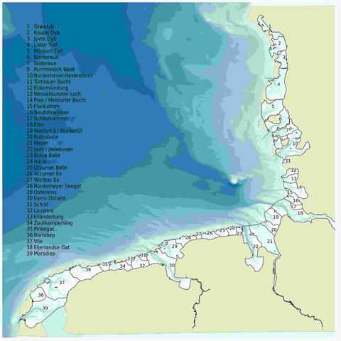
Distribution of the 39 tidal basins in the Wadden Sea.
Each of its basins displays the following features: salt marshes, tidal flats, tidal gullies, barrier islands and ebb-tidal deltas (see figure 2.4)
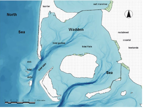
Figure 2.4: Geomorphological elements of the Wadden Sea coast (J. Hofstede).
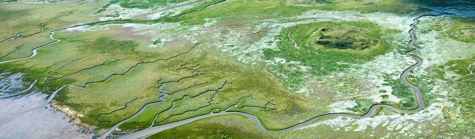
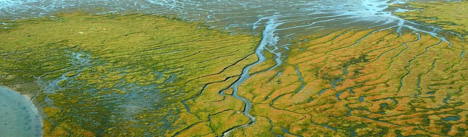
The existence of tidal basins is interrelated with barrier islands and elevated sandbars. Between these, the tidal flow is compressed and scours deep tidal inlets (up to 30 m depth) with a mean flow of about 1 m s-1. Behind the barrier islands, most inlets branch into major tidal channels which, in turn, branch into successively smaller tidal creeks or runnels in a recurrent fractal pattern.
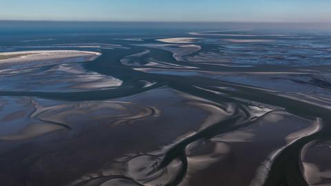
Photo of a tidal flat with channels and creeks
Waves, tides and wind are important characteristics of the Wadden Sea region. Twice a day, the tides move an average volume of 15 km³ of seawater through the tidal channels and inlets into the tidal basins where roughly the same volume remains at low tide, thus swelling up to 30 km³ at high tide.
Strong onshore winds may increase high tides up to 4 m above mean high tide. Strong offshore winds are less frequent and may push low tides down to 1.5 m below mean low tide level.
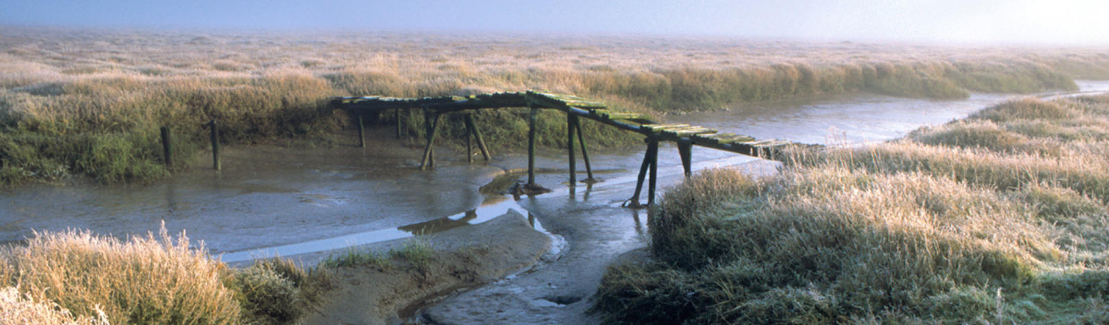
Tidal flats often remain submerged over several days due to prevailing westerly winds. This contributes to the dominance of marine over terrestrial organisms in the tidal zone of the Wadden Sea.
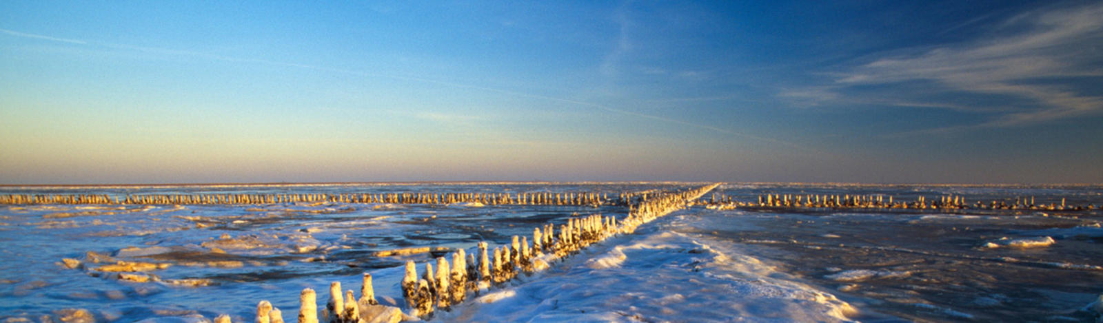
The hydrological and geomorphological relations are highly sensitive to change in sea level and variations in storminess. Accordingly, the geomorphology remains very dynamic. Small islands emerge and others disappear in the course of the centuries such as the islands of Bosch in the Dutch part and Buise in the German part of the Wadden Sea.
However, there never was and still is no morphological equilibrium. Permanent change is the consequence of variations in sea level, tidal range and climate. Shallow seas and flat land also meet at other coasts of the world; however, the Wadden Sea has developed a unique geomorphology with its specific combination of physical factors and their interactions with the regional biota.